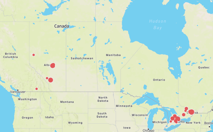
A few days ago, I wrote about our efforts to track infectious respiratory disease in dogs, based on informal reports of potentially increased disease activity in a couple of areas (particularly Calgary AB and Guelph ON). Click here for the latest version of our canine infectious respiratory disease complex (CIRDC) map.
As expected, once we started asking, we started getting more reports of sick dogs in several areas. There are also some interesting potential links. For example, numerous cases from Edmonton have a link to Lauderdale dog park. It’s unclear whether that means there’s a true cluster associated with the park versus it simply being a very busy park frequented by a lot of dogs (sounds like it is) versus people being more likely to report exposure to that park. But it’s something to consider, and that’s a large reason why we do this kind of data collection. We’re not trying to get really accurate and specific information, we’re simply trying to spot trends and find things on which we can potentially act. The more data we have, the more we can hopefully figure out.
So veterinarians and dog owners, please keep reporting cases of dogs with suspected infectious respiratory disease through our survey, even if the signs are relatively mild. It’s quick and anonymous.
A few disclaimers:
- The survey results and map are always going to be biased, since we depend on people to report cases. A cluster of cases can be a cluster of increased disease or a cluster of increased reporting.
- For privacy reasons, we plot cases at the FSA level (forward sortation area, aka first 3 digits of the postal code). Where the dot ends up on the map isn’t reflective of the exact location of the reports. (As I said in a Tweet about dots on the map, please don’t yell at me if your house ends up under a dot. It’s not supposed to be that accurate.)
